November 28, 2022
How To Prevent Water Disasters Using FEMA Flood Maps
Moving into your dream home can easily turn into your worst nightmare if it is constantly threatened by rising flood waters or storm floods. When looking to find your dream home, be sure to assess the flood risk as part of your purchase considerations. Knowing how to go about evaluating this risk, will help you to make a wise and low flood risk investment.
Flood maps are used to establish flood insurance terms, contract requirements, and policy pricing by property owners, insurance brokers, and lenders.
Important to note: Every five years, FEMA is obligated to update community flood maps. In the event that a map is not updated within a 5-year period, the flood danger or risk is deemed “unknown”. FEMA must evaluate flood maps on a regular basis in order to stay informed of prospective flood situations, stay ahead of any flood risk, and update or modify local insurance rates.
What Factors Can Influence a Flood Map?
FEMA flood maps are updated often across the country to maintain an accurate depiction of a community’s flood risk. The following factors can influence the likelihood of your property being affected by floods, which will result in your home needing water damage restoration:
- Neighborhood Development
- Significant Construction Projects
- Changes in the weather
- Changes in the landscape
Interesting to note is that certain changes or undertakings will also have an influence on the flood risk, and these can include dams, diversions, and levees. Over time, these can help in reducing the risk of floods and with that the need for flood cleanup.
Good to know: You can ask FEMA for a Letter of Map Change (LOMC) if you believe that your property has been mistakenly mapped in a high-risk area. This can also apply if your area has recently undergone significant changes such as major developments or large construction projects.
How To Determine the Flood Risk for Your Property
If you are in the market for property purchase or if you are planning to move to an area located in a high-risk flood zone, keep in mind that flood insurance will most likely be required. You will want to avoid having to deal with flood removal, general water clean up and water damage restoration all by yourself, with no insurance coverage. It is simply not worth the risk. In most cases homeowners insurance or renter’s insurance will not cover any type of flood damage, including water restoration. According to statistics, if your property is situated in a low to moderate flood risk area, it is five times more likely that you will
experience a flood rather than a fire, over a 30-year period.
For an overview of flood risks in your area, start with visiting the following page: msc.fema.gov/portal/search
Towards the top of the page, find the search field.
Enter the address you wish to look up, then click “search”.
Once the map of your area comes up, you can view it either in its base or topography format, or switch to street view, if preferred.
After this, visit msc.fema.gov/portal/home and enter your address once more. You will now have the dynamic flood map overlaid on your first base map.
Take note – For the precise location you specified during the map search, you will receive the following information:
A map number and the date on which it became effective, i.e. number13089C0083K, as of 12/08/2016
A document with the updated dynamic map
Any amendments that apply
Revalidations that apply
Good to know: Make sure to give the website enough time to process any new request for a flood map search in the service center, as it can take up to two minutes.
The aforementioned documents created by the FEMA service center can be saved and printed. These can then be utilized by a variety of professional services, including insurance brokers, financial institutions, and property owners. By analyzing the information contained herein they will be able to determine things like flood insurance terms, contract inclusions, and policy costs.
Rates for National Flood Insurance.
People sometimes ask whether FEMA is the sole provider of flood insurance. This used to be the case, but things have changed in recent years. In 2019 federal regulators permitted mortgage lenders to accept private flood insurance policies, provided that they followed specific guidelines. This cleared the way for independent insurers to enter this market. In the United States, there are currently more than 100 insurance providers of flood insurance, but of course, the National Flood Insurance Program also still offers flood coverage. Many homeowners prefer to take out supplementary insurance cover over and above this program’s cover to ensure adequate coverage in the event of severe weather conditions that causes extreme flooding. Flood cleanup & water damage restoration costs are amongst the items that homeowners seek coverage for.
In order to determine the flood insurance policy costs, there are several factors that are taken into account. These factors include the age of the property, how many levels the property has, what the flood risk is, and of course the amount of cover requested.
The average annual cost of flood insurance in the United States is about $700, according to bankrate.com.
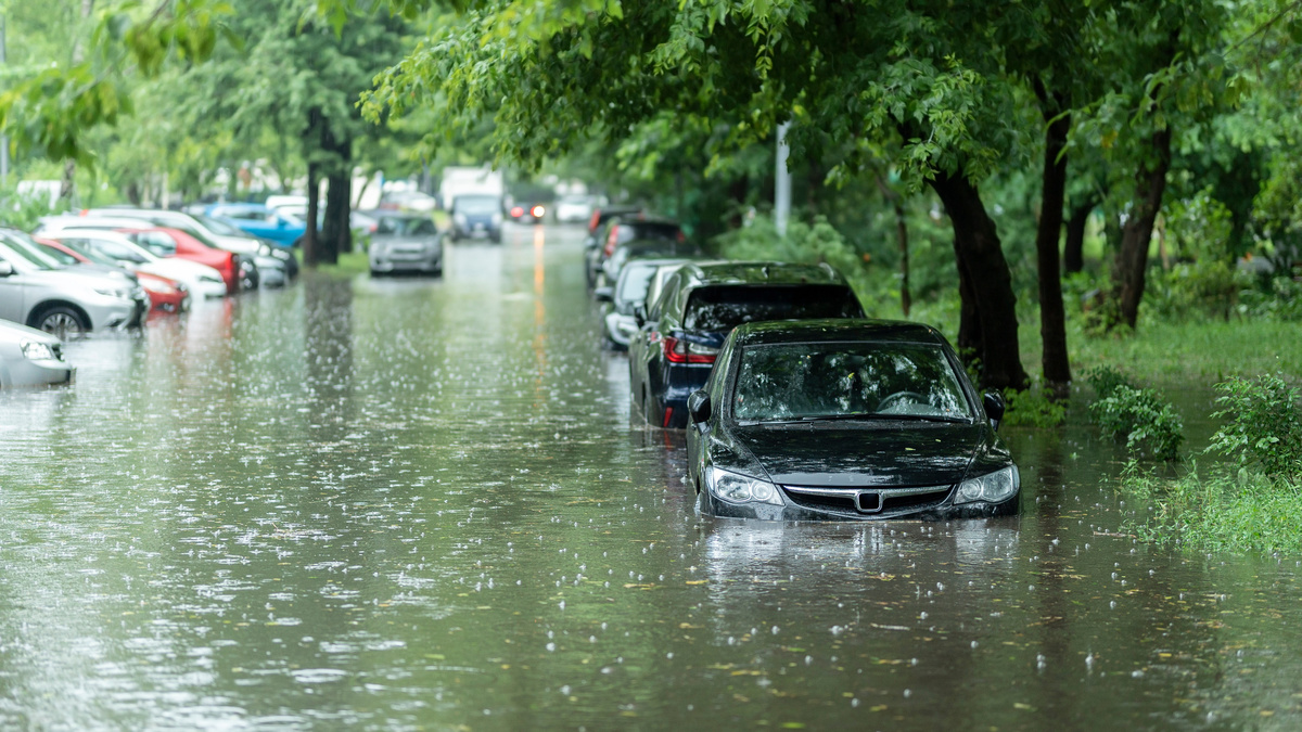
Flooding: Flooding can quickly result in expensive property damage and getting in touch with your insurance broker right away is the first action to take. Once the policy is activated, the process of flood removal and water restoration and more, can commence.
Flood Insurance Inclusions: Your home and the items within are covered by flood insurance.
Cut Your Insurance Costs: The best way to lower costs would be to lower your flood risk.
Here are some ideas of how you can reduce your flood risk and subsequently reduce your insurance costs:
FEMA has stated that it’s possible to lower your insurance costs by raising your home higher and using the ground floor for garage and storage, instead of living space. It can also help to reduce your insurance rates by building your home on the most elevated part of your property rather than a lower-lying section.
Another idea is to elevate your home above the flood level, by building or raising it on stilts.
You could also consider elevating the utilities of the home higher than the base flood level. By raising the furnace, water heater, and air conditioner above the baseline can lessen the likelihood of costly damage, which will result in cheaper insurance costs.
By incorporating certain structural allowances, you can also reduce the risks and associated costs of the water clean up. Make sure the foundation walls have gaps where the floodwater can be channeled through. Living space can be seriously compromised if flood waters slam up and around the property’s foundations. If the water can easily pass through, less water and structural damage can occur. Less risk equals lower insurance rates.
In Conclusion
When it comes to flood maps and floor insurance, through this post you have hopefully gained some valuable insight. We have discussed what a flood map is, how it is changed and how it influenced the federal flood insurance premium rates.
You can lower your flood insurance costs by making a few minor (or major) changes to your home and property. The variations in land elevation may be sufficient to reduce your property’s flood risk and risk of severe damage.
If you don’t take relevant steps to reduce your home and property’s flood risks, you can end up paying higher insurance premiums and be left out of pocket if tragedy were to strike.
Contact McKinley Water Damage Restoration today to find out more about your home’s flood risk and how it can be reduced.